
UAE Closes Umm Al Quwain Beaches After Offshore Oil Spill as Analysts Point to Gem No. 2
The United Arab Emirates has temporarily closed all beaches and coastal areas around Umm Al Quwain after an offshore tanker oil spill reached parts of the coastline. Containment, cleanup and environmental assessment operations are underway, and fishermen have been warned to avoid affected waters. Independent analysts have identified the tanker Gem No. 2 as a possible source, with satellite imagery suggesting an oil slick covering approximately 160 square kilometers. UAE authorities, however, have not officially identified the vessel or established the cause of the spill.
Authorities in the United Arab Emirates have temporarily closed all beaches and coastal areas around Umm Al Quwain after an offshore tanker oil spill reached parts of the emirate’s coastline, prompting containment operations, environmental assessments and warnings for fishermen and other sea users to stay away from affected waters.
The UAE Ministry of Climate Change and Environment said Friday that its technical monitoring and environmental assessment systems had detected oil pollution linked to a tanker offshore and that response teams were working with local and federal authorities to contain the spill, clean affected areas and limit further damage to the marine environment.
All beaches and coastal areas in Umm Al Quwain were ordered temporarily closed while technical teams assessed the scale of contamination and determined what additional safety and environmental measures were required. Authorities in neighboring Sharjah also temporarily closed Al Hamriyah Beach as a precaution because of concerns that oil could move along the northern UAE coastline.
The ministry warned fishermen and other people using the sea to avoid affected areas and follow official instructions while survey and cleanup operations continue. Coastal monitoring teams are assessing the spread of the oil and examining the possible impact on beaches, marine ecosystems and critical coastal infrastructure.
Authorities also addressed reports of strong fuel-like odors in Umm Al Quwain, Ajman and Sharjah. The ministry said the odors being reported by residents did not pose a health risk, although the public was advised to avoid direct contact with oil that reaches the shoreline and to rely on official announcements rather than unverified social-media claims.
The UAE government has not publicly named the tanker responsible for the spill and has not announced an official cause. That distinction is important because maritime intelligence analysts and environmental researchers have separately identified a vessel they believe is linked to the pollution, but their findings have not yet been formally adopted by UAE authorities.
Martin Kelly, chief executive of Orbital Risk Intelligence, told Reuters that analysts believe the oil is leaking from the very large crude carrier Gem No. 2. Satellite images from October 19 and October 21 were examined by researchers who said they appeared to show a substantial oil slick extending from the tanker.
Leon Moreland, a researcher with the Conflict and Environment Observatory, estimated from satellite imagery that the visible slick covered approximately 160 square kilometers. He said its size and proximity to land increased the possibility that oil could reach beaches and environmentally sensitive coastal habitats.
Those estimates are based on independent satellite analysis rather than an official UAE environmental assessment, and authorities have not yet published their own confirmed measurement of the spill’s total surface area.
The Gem No. 2 is a Panama-flagged very large crude carrier measuring about 330 meters in length and capable of transporting roughly two million barrels of crude oil. Shipping databases identify the vessel as a 2017-built tanker with a deadweight capacity of more than 300,000 tonnes.
The tanker had already attracted international attention earlier this month after a vessel believed by multiple maritime and security sources to be the Gem No. 2 was struck by an unidentified projectile off the UAE coast on October 9.
The United Kingdom Maritime Trade Operations agency said at the time that a vessel had been hit approximately 13 nautical miles west of Al Jazeera in the UAE, causing a fire that was later extinguished. UKMTO did not publicly name the ship, but shipping and security sources identified it as Gem No. 2.
No group claimed responsibility for that strike, and authorities did not publicly establish who fired the projectile. The incident occurred during a period of heightened maritime security risks across Gulf shipping routes.
The tanker’s 22 Indian crew members were subsequently rescued and reported safe. The Indian Consulate in Dubai confirmed on October 11 that all crew members aboard MT Gem No. 2 had been evacuated, while UAE authorities said those rescued received first aid before being transferred to the appropriate agencies.
The existence of that earlier incident has raised questions about whether damage from the October 9 strike is connected to the oil now affecting Umm Al Quwain. However, UAE authorities have not publicly made that link, and no official investigation result has established that the attack caused the current spill.
For that reason, the Gem No. 2 should be described at this stage as a possible or analyst-identified source rather than the officially confirmed tanker responsible for the contamination.
The spill has raised significant concern because the waters off Umm Al Quwain, Sharjah and Ajman contain ecologically sensitive coastal habitats as well as ports, desalination infrastructure and fishing areas.
Maritime intelligence firm Windward warned that currents could carry oil southwest toward coastal facilities, including port areas and desalination intakes in Sharjah and Ajman. Its modeling indicated that pollution could affect infrastructure depending on current patterns, weather conditions and how quickly containment teams are able to limit the spread.
Desalination infrastructure is particularly important in the UAE because the country relies heavily on seawater desalination for its drinking-water supply. Oil contamination near intake systems can force operators to take additional protective measures or temporarily alter operations if pollution reaches critical thresholds.
There was no official announcement Friday that desalination plants had been shut down because of the spill, and any suggestion that drinking-water supplies had already been disrupted would be premature. Authorities are continuing to monitor the coastline and the movement of the slick.
The environmental risk extends beyond industrial infrastructure. Oil spills can damage mangroves, intertidal habitats, fish breeding grounds, seabirds and other marine species if crude oil or heavy petroleum products reach shallow coastal areas.
The severity of environmental damage depends on several factors, including the type and volume of oil released, how long it remains in the water, weather conditions, current direction and how rapidly response teams deploy containment equipment and shoreline cleanup crews.
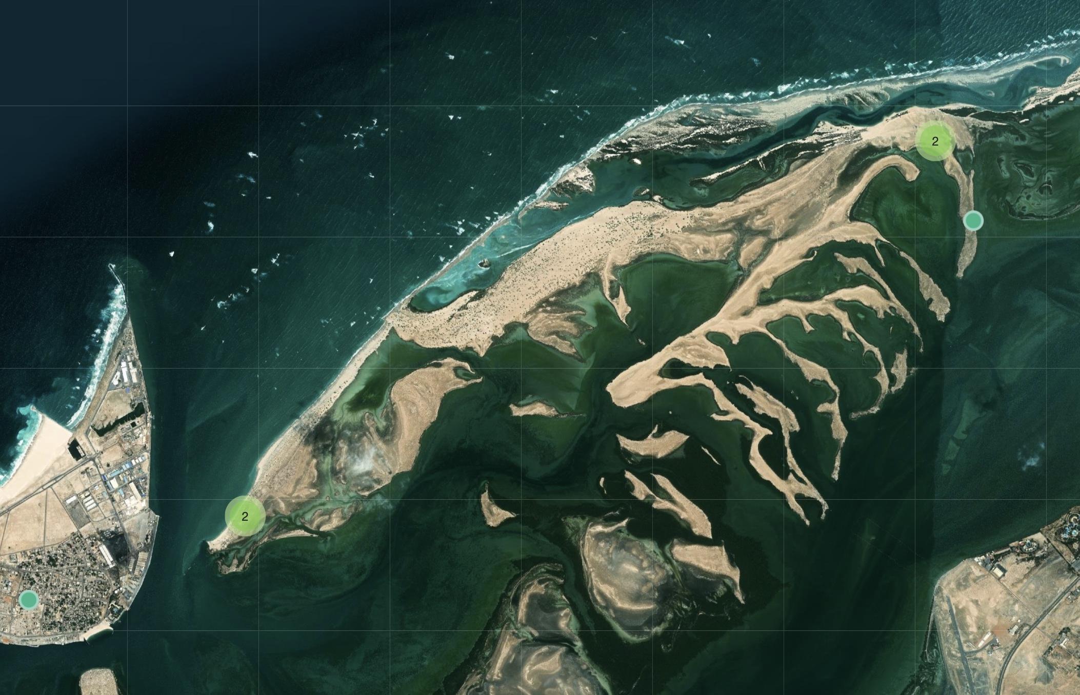
Umm Al Quwain contains extensive shallow-water environments, lagoons, mangrove habitats and coastal ecosystems that support marine life and fishing activity. Pollution reaching these areas can be difficult to remove because oil can settle into sediments, coat vegetation and persist in protected tidal zones.
The decision to warn fishermen away from affected waters is therefore both a safety and environmental measure. Fishing vessels can interfere with cleanup operations, while contact with contaminated water or catch from polluted zones may create additional concerns for crews and consumers.
The ministry has not announced how long the beach closures will remain in effect. Officials said restrictions would continue until technical teams complete their evaluations and determine that conditions are safe for public access and marine activities.
Umm Al Quwain Municipality said field teams were working to identify contaminated areas, support cleanup operations and reduce damage to both the shoreline and marine environment. Specialists are also expected to continue sampling and monitoring as the response develops.
The event comes at a particularly sensitive time for Gulf shipping. Maritime security risks have risen sharply in recent weeks, with commercial vessels facing attacks, projectile strikes and other incidents across the Gulf and nearby waters.
On October 9, UKMTO’s report of the projectile strike west of Al Jazeera added to concerns that attacks were spreading beyond the Strait of Hormuz itself. Maritime security companies subsequently urged commercial operators to increase vigilance and monitor threat information closely.
The Strait of Hormuz and surrounding Gulf waters are among the most strategically important energy corridors in the world. Large volumes of crude oil, refined products and liquefied natural gas move through the region every day, making disruption to shipping or environmental contamination a concern far beyond the UAE.
Friday’s oil spill also contributed to renewed concern in global energy markets. Brent crude climbed as traders assessed a series of supply and security risks across the Middle East, including attacks on energy infrastructure and commercial shipping.
The spill itself does not necessarily imply a major interruption in UAE oil production or exports, but it adds to wider uncertainty surrounding maritime transport and the safety of tankers operating in the region.
For coastal authorities, however, the immediate focus remains environmental containment rather than oil-market consequences. Teams are working to limit the movement of the slick, protect sensitive coastal locations and determine the full scale of contamination.
The UAE’s response will likely involve continued aerial and satellite monitoring alongside vessel-based inspections and shoreline surveys. Such monitoring is essential because oil slicks can break into separate patches and travel significant distances depending on winds and currents.
Investigators will also need to determine where the leak originated on the tanker involved, when it began and whether the release is continuing. Authorities have not said whether the source has been fully stopped.
That question will be critical to the cleanup effort because containment is considerably more difficult if petroleum is still entering the water. A continuing leak could expand the affected area even as response crews remove oil from previously contaminated zones.
Another unresolved issue is the exact volume of oil released. The approximately 160-square-kilometer figure refers to the estimated surface area of the slick visible in satellite imagery and should not be interpreted as a direct measurement of the amount of crude oil in the water.
A thin sheen can cover a very large surface area, while thicker concentrations of oil may occupy smaller sections of the same slick. Determining the actual volume lost generally requires additional information about the vessel, tank damage, oil thickness and duration of the leak.
The UAE has not released those figures.
The role of Gem No. 2 will also remain under scrutiny. Analysts say satellite imagery appears to connect the slick to the tanker, and earlier maritime reporting established that a vessel identified by security sources as Gem No. 2 suffered a projectile strike and fire on October 9. But until UAE authorities complete their investigation, neither the identity of the leaking tanker nor the connection between the earlier strike and the present pollution should be treated as officially established.
That distinction is particularly important given the wider regional conflict and the possibility that premature attribution could carry political and security implications.
No government or armed group has been officially identified as responsible for causing the spill. No group claimed responsibility for the October 9 projectile strike either.
Authorities are expected to provide further updates as environmental surveys progress and cleanup teams assess the coastline. Those updates should clarify the extent of shoreline contamination, whether the leak has been stopped, how long beaches will remain closed and whether fishing restrictions need to be extended.
For residents, the strongest immediate advice remains to avoid affected coastal areas, follow government guidance and refrain from approaching visible oil deposits.
For the fishing and tourism sectors, the duration of the closures will be closely watched. Umm Al Quwain’s beaches and marine areas are used for recreation, tourism and commercial fishing, meaning prolonged contamination could produce economic as well as environmental consequences.
The incident could also renew discussion about tanker monitoring and emergency response in heavily trafficked Gulf waters. Very large crude carriers operating near populated coastlines pose significant pollution risks when damaged, even when crew members are successfully evacuated and fires are brought under control.
For now, the official position is limited but clear: a tanker-related oil spill has affected the Umm Al Quwain coastline, beaches and coastal zones have been temporarily closed, fishermen have been warned away, and containment and environmental assessment operations are underway.
The suspected connection to Gem No. 2 is supported by independent analysts and satellite imagery but remains unconfirmed by UAE authorities. The cause of the spill likewise has not been officially established, leaving investigators with two central questions as cleanup continues: which vessel is responsible and what caused the release.
Until those findings are made public, the environmental response remains the most urgent priority, particularly as authorities monitor whether oil reaches sensitive habitats, ports or desalination infrastructure along the northern UAE coast.